


Babylon 🇺🇸
-
Nautical Twilight begins:04:40 amSunrise:05:47 am
-
Sunset:07:53 pmNautical Twilight ends:09:00 pm
-
Moonrise:03:55 am
-
Moonset:03:55 pm
-
Moon over:09:55 am
-
Moon under:10:07 pm
-
Visibility:16%
-
 Waning Crescent
-
Distance to earth:363,333 kmProximity:99.5 %
Moon Phases for Babylon
-
good Day
-
minor Time:02:55 am - 04:55 am
-
major Time:08:55 am - 10:55 am
-
minor Time:02:55 pm - 04:55 pm
-
major Time:09:07 pm - 11:07 pm
Tide Clock
Tide Graph
Times
| Tide | Time | Height |
|---|---|---|
| low | 02:06 am | 0.07 ft |
| high | 07:22 am | 0.79 ft |
| low | 02:29 pm | -0.03 ft |
| high | 08:00 pm | 0.82 ft |
| Date | Major Bite Times | Minor Bite Times | Sun | Moon | Moonphase | Tide Times |
|---|---|---|---|---|---|---|
|
Sat, 04 May
|
08:55 am -
10:55 am
09:07 pm -
11:07 pm
|
02:55 am -
04:55 am
02:55 pm -
04:55 pm
|
R: 05:47 am S: 07:53 pm |
R: 03:55 am S: 03:55 pm |
Waning Crescent |
low: 02:06 am
, 0.07 ft
high: 07:22 am
, 0.79 ft
, Coeff: 120
low: 02:29 pm
, -0.03 ft
high: 08:00 pm
, 0.82 ft
, Coeff: 128
|
|
Sun, 05 May
|
09:45 am -
11:45 am
09:58 pm -
11:58 pm
|
03:19 am -
05:19 am
04:11 pm -
06:11 pm
|
R: 05:46 am S: 07:54 pm |
R: 04:19 am S: 05:11 pm |
Waning Crescent |
low: 03:03 am
, -0 ft
high: 08:22 am
, 0.79 ft
, Coeff: 120
low: 03:18 pm
, -0.07 ft
high: 08:54 pm
, 0.89 ft
, Coeff: 145
|
|
Mon, 06 May
|
10:36 am -
12:36 pm
10:50 pm -
12:50 am
|
03:44 am -
05:44 am
05:28 pm -
07:28 pm
|
R: 05:45 am S: 07:55 pm |
R: 04:44 am S: 06:28 pm |
New Moon |
low: 03:58 am
, -0.03 ft
high: 09:18 am
, 0.79 ft
, Coeff: 120
low: 04:07 pm
, -0.07 ft
high: 09:45 pm
, 0.92 ft
, Coeff: 153
|
|
Tue, 07 May
|
11:29 am -
01:29 pm
11:13 pm -
01:13 am
|
04:12 am -
06:12 am
06:47 pm -
08:47 pm
|
R: 05:44 am S: 07:56 pm |
R: 05:12 am S: 07:47 pm |
New Moon |
low: 04:52 am
, -0.07 ft
high: 10:10 am
, 0.79 ft
, Coeff: 120
low: 04:55 pm
, -0.07 ft
high: 10:32 pm
, 0.95 ft
, Coeff: 162
|
|
Wed, 08 May
|
12:06 am -
02:06 am
12:25 pm -
02:25 pm
|
04:44 am -
06:44 am
08:06 pm -
10:06 pm
|
R: 05:43 am S: 07:57 pm |
R: 05:44 am S: 09:06 pm |
New Moon |
low: 05:44 am
, -0.1 ft
high: 10:59 am
, 0.79 ft
, Coeff: 120
low: 05:43 pm
, -0.07 ft
high: 11:18 pm
, 0.95 ft
, Coeff: 162
|
|
Thu, 09 May
|
12:57 am -
02:57 am
01:21 pm -
03:21 pm
|
05:22 am -
07:22 am
09:20 pm -
11:20 pm
|
R: 05:41 am S: 07:58 pm |
R: 06:22 am S: 10:20 pm |
New Moon |
low: 06:34 am
, -0.1 ft
high: 11:49 am
, 0.75 ft
, Coeff: 112
low: 06:30 pm
, -0.03 ft
|
|
Fri, 10 May
|
01:50 am -
03:50 am
02:18 pm -
04:18 pm
|
06:10 am -
08:10 am
10:27 pm -
12:27 am
|
R: 05:40 am S: 07:59 pm |
R: 07:10 am S: 11:27 pm |
Waxing Crescent |
high: 12:05 am
, 0.92 ft
, Coeff: 153
low: 07:22 am
, -0.07 ft
high: 12:41 pm
, 0.72 ft
, Coeff: 103
low: 07:16 pm
, 0 ft
|


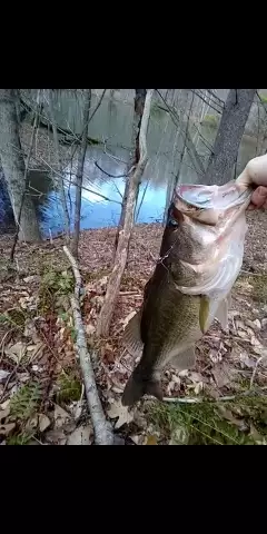
uploaded by: Mick.e

uploaded by: Mick.e

uploaded by: Mick.e

uploaded by: Andretheone

uploaded by: John Needham

uploaded by: Lee Smith 1

uploaded by: D2Turnt

uploaded by: PT Edward fisher

uploaded by: Charlie Pifer

uploaded by: Charlie Pifer
Best Fishing Spots in the greater Babylon area
Beaches and Bays are ideal places for land-based fishing. If the beach is shallow and the water is clear then twilight times are usually the best times, especially when they coincide with a major or minor fishing time. Often the points on either side of a beach are the best spots. Or if the beach is large then look for irregularities in the breaking waves, indicating sandbanks and holes. We found 12 beaches and bays in this area.
West Islip Beach - 3km , Venetian Shores Beach - 4km , Great South Bay Bridge - 5km , Bay Shore Marina - 7km , Cedar Beach - 7km , Cedar Overlook Beach - 7km , Copiague Beach - 7km , Amityville Beach - 8km , Bayberry Point - 9km , Town Beach - 9km , Gilgo Beach - 11km , Jones Beach Island - 11km
Harbours and Marinas can often times be productive fishing spots for land based fishing as their sheltered environment attracts a wide variety of bait fish. Similar to river mouths, harbour entrances are also great places to fish as lots of fish will move in and out with the rising and falling tides. There are 7 main harbours in this area.
Babylon Marina - 1km, Rainbow Marine - 1km, Suffolk Marine Center - 1km, Long Island Yacht Club - 2km, Bergen Point Yacht Club and Boat Basin - 2km, Bay Shore Marina - 7km, Robert Moses State Park Boat Basin - 10km
We found a total of 99 potential fishing spots nearby Babylon. Below you can find them organized on a map. Points, Headlands, Reefs, Islands, Channels, etc can all be productive fishing spots. As these are user submitted spots, there might be some errors in the exact location. You also need to cross check local fishing regulations. Some of the spots might be in or around marine reserves or other locations that cannot be fished. If you click on a location marker it will bring up some details and a quick link to google search, satellite maps and fishing times. Tip: Click/Tap on a new area to load more fishing spots.
Argyle Lake - 0km , Hawleys Lake - 1km , Sampawams Neck - 1km , Araca Canal - 1km , Pamequa Canal - 1km , Frederick Canal - 1km , Babylon Marina - 1km , Rainbow Marine - 1km , Suffolk Marine Center - 1km , Babylon Cove - 2km , Lake Capri - 2km , Little East Neck - 2km , Sampawams Point - 2km , Santapogue Point - 2km , Southards Pond - 2km , Long Island Yacht Club - 2km , Bergen Point Yacht Club and Boat Basin - 2km , Carlls River Bridge - 2km , Bergan Point - 3km , Elda Lake - 3km , Great East Neck - 3km , Keith Canal - 3km , Santapogue Neck - 3km , Sequatogue Neck - 3km , Willetts Point - 3km , West Islip Beach - 3km , Conklin Point - 4km , Little Neck - 4km , Okenok Neck - 4km , Venetian Shores Beach - 4km , Sylvan Road Bridge - 4km , Appletree Neck - 5km , Belmont Lake - 5km , Copiague Neck - 5km , Grass Island - 5km , Guggenheim Lakes - 5km , Indian Island - 5km , Isbrandtsen Canal - 5km , Strongs Point - 5km , Great South Bay Bridge - 5km , Brightwaters Canal - 6km , Cedar Island - 6km , Great Neck - 6km , Howell Point - 6km , Mirror Lake - 6km , O-co-nee Lake - 6km , Oak Island - 6km , Seganus Thatch - 6km , Thorn Canal - 6km , Nezeras Island - 6km , Gateway Lagoon - 6km , Lakeview Avenue Bridge - 6km , Lakeview Avenue West Bridge - 6km , Riviera Drive East Bridge - 6km , Riviera Drive West Bridge - 6km , Wellwood Avenue Bridge - 6km , Bay Shore Marina - 7km , Captree Island - 7km , Cedar Beach - 7km , Cedar Overlook Beach - 7km , Copiague Beach - 7km , Avon Lake - 8km , Bull Ditch - 8km , Democrat Point - 8km , Elder Island - 8km , Great Cove - 8km , Hemlock Cove - 8km , Penataquit Point - 8km , Thatch Island - 8km , Orowoc Point - 8km , Amityville Beach - 8km , Bayberry Point - 9km , East Canal - 9km , Great Island - 9km , Little Island - 9km , Middle Canal - 9km , Orowoc Lake - 9km , Town Beach - 9km , West Canal - 9km , Gilgo Island - 10km , Pardees Ponds - 10km , Sexton Island - 10km , Unqua Point - 10km , Wansers Island - 10km , Canal 6 - 10km , Canal 7 - 10km , Robert Moses State Park Boat Basin - 10km , Gilgo Beach - 11km , Gilgo Heading - 11km , Jones Beach Island - 11km , Knapps Lake - 11km , Lower Winganhauppauge Lake - 11km , Townsend Island - 11km , Upper Winganhauppauge Lake - 11km , Canal 8 - 11km , Canal 9 - 11km , Canal 10 - 11km , Fire Islands - 12km , Fort Neck - 12km
Comments